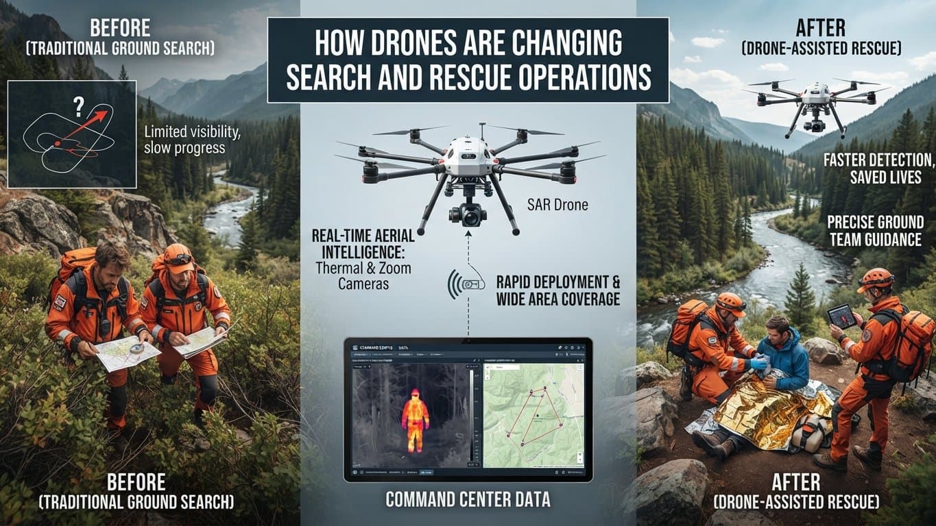


How Drones Are Changing Search and Rescue Operations
Search and rescue teams often work in places where time, visibility and access can become serious problems. A missing hiker, flood victim, wildfire survivor or injured person may be located across rough terrain that takes hours for a ground team to reach. Drone technology for rescue operations gives emergency teams an aerial view of these areas in minutes.
Modern UAVs for search and rescue can carry high resolution cameras, thermal sensors, LiDAR systems, GPS equipment and communication payloads. These systems help rescue crews collect information from areas that may be unsafe or difficult for people to enter. Drone assisted search and rescue is now becoming a practical part of emergency response programs across the Drone Industry.
How Drones Support Search and Rescue Teams
A rescue drone can cover large areas much faster than a ground crew walking through forests, mountains, damaged buildings or open fields. Operators can send the aircraft over a search zone and review live video from a remote control station.
The biggest benefit is situational awareness. A rescue team can see roads, trails, damaged structures, water channels and possible victim locations from above. This information helps team leaders decide where personnel should move first.
Drones for emergency response can support several tasks, such as:
Searching large areas after a person goes missing
Monitoring flood zones and rising water
Locating people after earthquakes or structural collapse
Supporting wildfire evacuation and rescue activities
Checking remote roads and damaged infrastructure
Delivering small emergency supplies to isolated people
A drone in search and rescue does not replace firefighters, police officers, medical teams or search specialists. It gives those teams another source of information, and that can save valuable minutes.
Thermal Imaging Drones for Rescue Operations
Thermal imaging drones for rescue operations are especially useful when visibility becomes poor. A thermal camera detects heat signatures rather than depending only on normal light. This can help operators identify people in forests, fields, smoke filled areas or locations where visual inspection is difficult.
During nighttime searches, thermal sensors can help identify a human heat signature against cooler surroundings. Rescue teams can then examine the location using standard cameras or send personnel toward the suspected position.
Thermal imaging has limits too. Hot rocks, vehicles, animals, buildings and other objects can create confusing readings. Weather conditions, vegetation and distance can affect sensor performance. A trained operator must review the information instead of assuming every bright thermal image represents a person.
This is where modern aerial search and rescue technology becomes useful. Combining thermal imagery with visible cameras, GPS information and mapping data can give responders a more complete picture of the search area.
Drones for Disaster Response
Natural disasters can change an area within minutes. Floods can block roads, earthquakes can damage buildings, and wildfires can cut off communities. Drones for disaster response give emergency agencies a way to inspect affected locations without sending people into every dangerous area.
After a disaster, UAVs can capture aerial photographs and video for damage assessment. Teams can use these images to identify blocked roads, damaged bridges, collapsed structures and isolated communities.
Drone based mapping can support:
• Disaster site assessment
• Flood monitoring
• Wildfire observation
• Search area mapping
• Infrastructure inspection
• Emergency route planning
The collected information can be shared with emergency coordinators, public safety agencies and field teams. Aerial information can help different groups work from the same operational picture, though communication procedures still need to be managed carefully.
Drone Technology for Rescue Operations
Modern rescue drones are becoming more capable through improvements in flight control, sensors, communications and onboard computing. Some aircraft can follow programmed routes and return to a designated location when their mission is complete.
Autonomous flight features can reduce the workload for operators during large area searches. A drone may follow a planned grid over a forest or open field and collect imagery across the search zone. Operators can then review the captured data for possible signs of a person or object.
AI based image analysis can support this process by identifying shapes, movement or unusual objects in large collections of aerial images. Human review remains necessary since environmental conditions can produce false results. Technology is useful, but rescue decisions still need experienced people.
Payload selection matters too. A rescue aircraft may carry thermal cameras for night searches, optical cameras for daytime observation, loudspeakers for communication or small delivery systems for emergency supplies.
Security and Safety in Drone Assisted Rescue
Drone security is an important part of emergency UAV operations. Rescue teams may collect sensitive images of accident locations, private property and people in distress. Unauthorized access to this information can create privacy and operational risks.
Secure communication links can help protect information between the drone and ground control station. Agencies should use controlled access, encrypted communications, secure storage and clear data retention policies.
Flight safety matters just as much. Emergency operations can involve helicopters, airplanes, power lines, buildings and large groups of people. Drone operators need clear flight procedures and coordination with other aircraft.
Good rescue programs normally include:
Trained drone pilots and mission operators
Defined flight zones and operating procedures
Secure communication systems
Battery and equipment checks
Emergency landing procedures
Data protection policies
Coordination with aviation authorities and emergency agencies
The Future of Aerial Search and Rescue Technology
The Drone Industry is moving toward systems that combine autonomous flight, advanced sensors, AI supported analysis and improved communications. Future rescue platforms may search larger areas with less manual control and provide useful information to emergency teams faster.
Drone fleets may become more common for major disaster operations. Multiple aircraft can potentially cover different sections of a search area, collect imagery and send information to a central operations team.
The real value of UAVs for search and rescue is not simply that they fly. Their value comes from the information they collect and how quickly rescue teams can act on it. Aerial imagery, thermal detection, mapping and real time communication can make emergency operations more informed and more organized.
Frequently Asked Questions
How are drones used in search and rescue?
Drones are used to search large areas, locate people, inspect dangerous locations, monitor disasters and provide aerial information to rescue teams.
Can drones find people at night?
Yes. Drones equipped with thermal imaging cameras can detect heat signatures during nighttime operations. Results depend on weather, terrain, distance and sensor capability.
What types of drones are used for rescue operations?
Rescue teams may use multirotor UAVs for close area inspection and fixed wing aircraft for larger search zones. Aircraft selection depends on mission distance, weather, payload and flight requirements.
Can drones replace search and rescue teams?
No. Drones support rescue personnel by providing aerial information and reducing the need to send people into some dangerous locations. Human teams remain responsible for rescue decisions and physical assistance.
Why are drones useful during disasters?
Drones can quickly inspect damaged areas, map affected locations, identify access routes and help locate people in places where ground access is difficult.
Drones are becoming a practical tool for emergency response, disaster response and search operations. As sensor technology, autonomous flight and data analysis continue to improve, UAVs can give rescue teams better information at the moment it matters most. The aircraft may be small, but the information it provides can make a serious difference during an emergency.